The Canals of Newcastle-under-Lyme by Ben Boult
Many of you will have heard of ‘the canal’ that once passed through Newcastle. But did you know that there were actually three canals in and around the town centre? The Gresley Canal; the Junction Canal (aka the ‘Upper Canal’) and the Newcastle Canal (aka the ‘Lower Canal’):
Canal 1 - The Gresley Canal
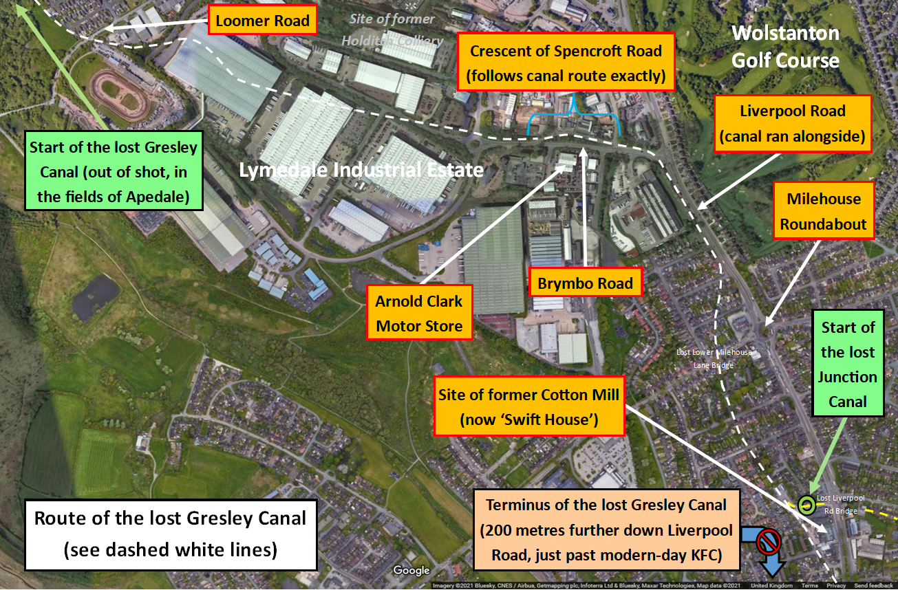
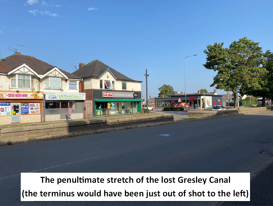
The Gresley Canal took its name from Sir Nigel Gresley (1726 – 1787). Gresley was a significant landowner in and around Newcastle and held rights to the coal mines of Apedale. To better supply Newcastle with coal from those mines, he promoted a Bill through Parliament to build a canal from Apedale to Newcastle. Gresley’s plans were approved by MPs and the Canal Act received Royal Assent in 1775. The exact date of the canal’s opening is unclear, but it likely opened the following year. The canal was 3 miles in length, reached a depth of 5 feet and terminated at a wharf alongside Liverpool Road (just by the entrance to modern-day Roberts Avenue).
Interesting facts about the “Gresley Canal”:
1) The mines at Apedale helped to supply the canal with water.
2) Under the terms of the Canal Act, a stock of coal had to be kept at the wharf by Liverpool Road (if the canal froze, this helped to keep the town supplied with coal).
3) For landowners and farmers occupying adjacent lands, they could transport manure along the canal free of charge!
4) The canal’s fate was sealed once the Apedale railway opened. From 1857, only a small amount of traffic continued to use the canal – for instance, we know that two boat loads of coal were sent to the Cotton Mill on Liverpool Road between the 1860s and 1880s, one on the last day of the year and another on the first day of the following year. All traffic on the canal ceased after this time, however.
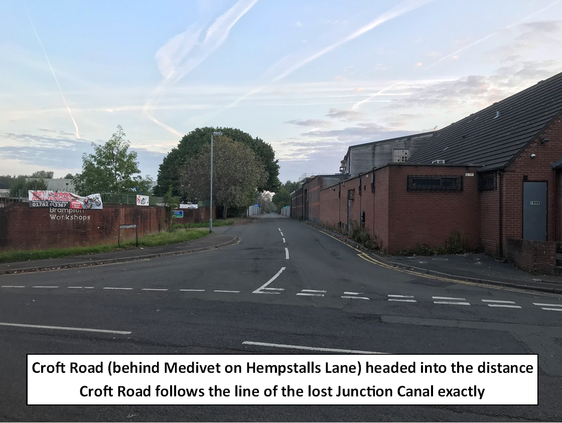
Canal 2 - The Junction Canal
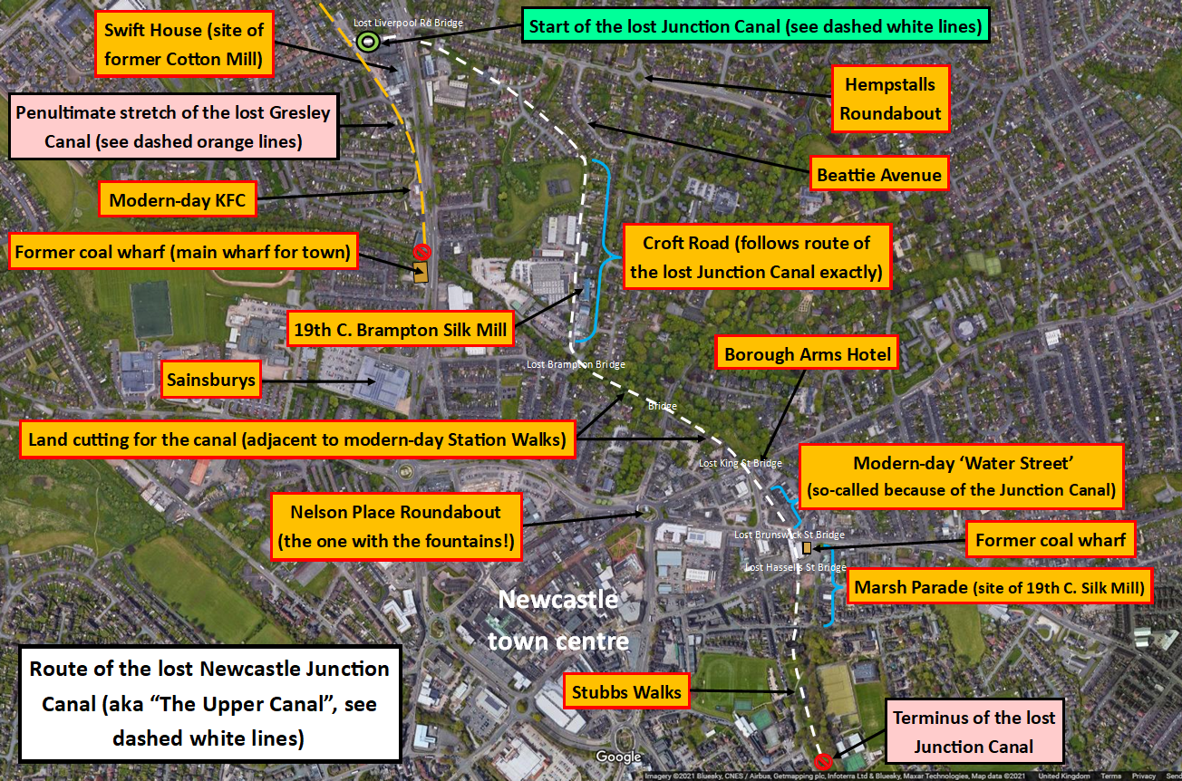
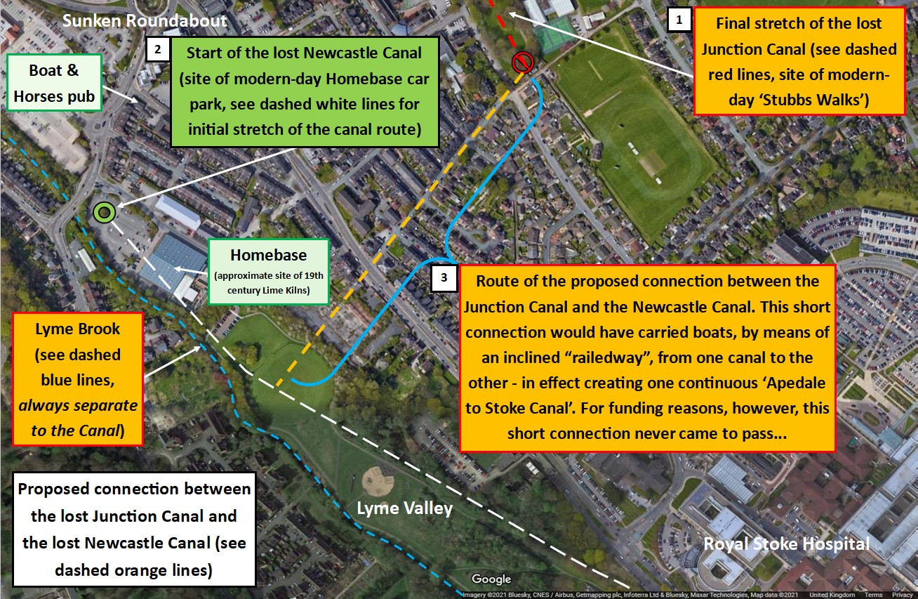
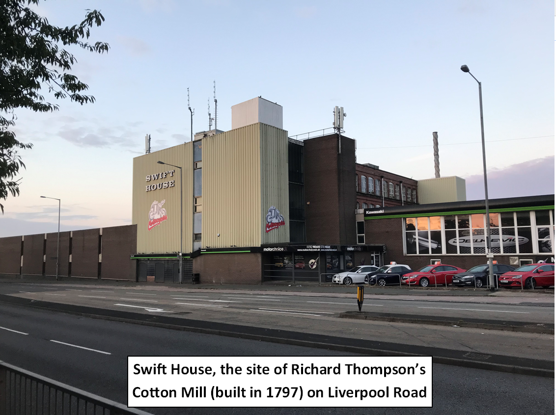
The Junction Canal was authorised by Act of Parliament in 1798 and opened - in part - in around 1801. The principal aim of the financiers of the Junction Canal was to join the Gresley Canal with the Newcastle-under-Lyme Canal – in effect creating one continuous ‘Apedale to Stoke’ canal. As envisioned, the Junction Canal would have run from the site of the Cotton Mill on Liverpool Road, Newcastle (the site of today’s ‘Swift House’) to the basin of the Newcastle-under-Lyme Canal by Brook Lane (the site of today’s Homebase car park). From an economic perspective, it would have enabled the transport of cheap coal from Apedale all the way to the industrial heartland of Stoke (and beyond via its connection with the Trent and Mersey Canal…). It is perhaps unsurprising, therefore, that Josiah Wedgwood and Josiah Spode - Stoke’s foremost pottery manufacturers - were among the canal’s shareholders.
The founding aim of the canal’s backers was never achieved, however, with the Junction Canal only ever reaching the site of modern-day Stubbs Walks. The main obstacle hindering the completion of the canal was a difference in altitude between its de-facto terminus and the basin of the Newcastle-under-Lyme Canal – with the terminus of the Junction Canal being some 88 feet higher than the basin of the Newcastle Canal. An inclined railway had been proposed to bridge the gap between the two sites, which would have enabled canal boats to traverse up and down the valley on a railway wagon. However, the financial risks associated with the work were too great for the Junction Canal’s shareholders, and ultimately, the connection never came to pass.
Interesting facts about the Junction Canal:
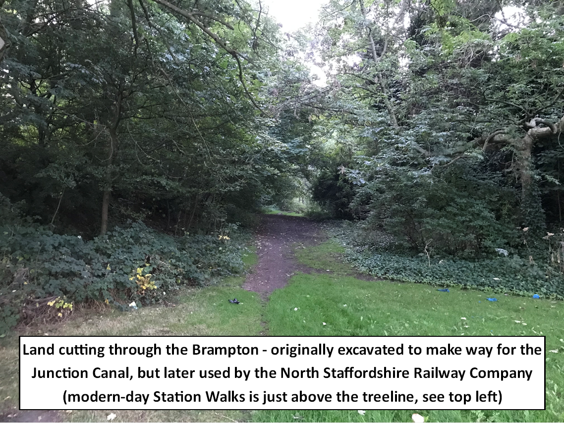
1) A 450 yard cutting, reaching a depth of 65ft deep in places, had to be made through the Brampton for the canal to chart the course that it did. Half a century later, this cutting would be acquired by the North Staffordshire Railway Company (NSR) in order to accommodate their new railway line (the cutting can still be seen today below modern-day Station Walks). This purchase meant that NSR avoided having to make a separate (and more expensive) cutting elsewhere.
2) The Junction Canal was allowed to draw water from the Gresley Canal, provided that it didn’t compromise the Gresley’s “highest present water level”.
3) The Junction Canal could not be used to provide the residents of Newcastle with cheap coal - this remained the lucrative preserve of the Gresley Canal.
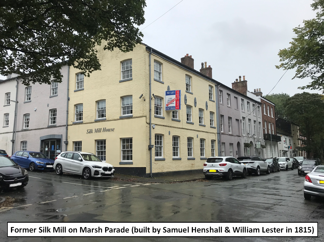
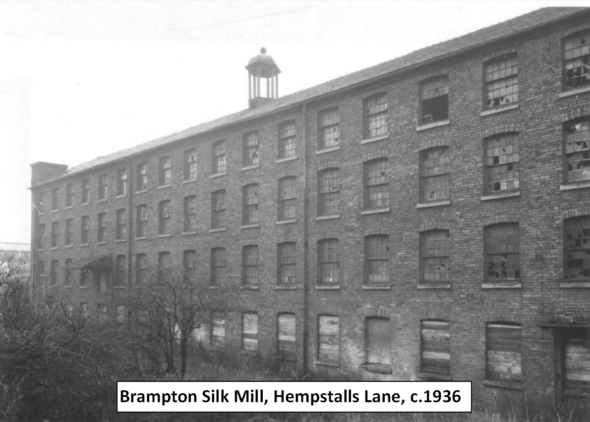
4) One source of profit for the proprietors of the Junction Canal was the supply of water to factories / mills along its path for use in their steam engines (for instance, the Brampton Silk Mill and the Silk Mill located on Marsh Parade).
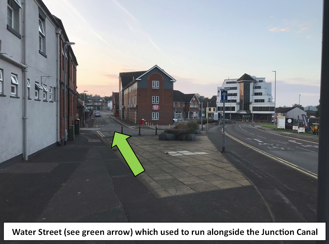
5) “Water Street”, which joins the rear of the Borough Arms Hotel with Marsh Parade, takes its name from the Junction Canal, as the canal used to run directly alongside it.
6) The canal had fallen out of use by 1860, and its land was gradually sold off over the next 5 years.
Canal 3 - The Newcastle Canal
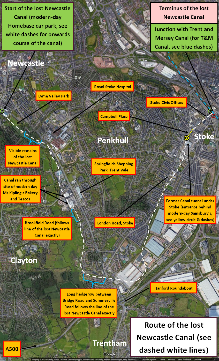
Construction of the Newcastle-under-Lyme Canal was authorised by Act of Parliament in 1795 and was completed in c.1800. It started out at Brook Lane, Newcastle (the site of today’s Homebase car park) and ran all the way to the Trent and Mersey Canal in Stoke. It charted a very indirect route to Stoke owing to the hilly landscape of Penkhull (i.e. it had to go the long way round!). In total, the Newcastle Canal was almost 4 miles in length.
Interesting facts about the Newcastle Canal:
1) It was mainly used to transport limestone from quarries in the Staffordshire Moorlands to the limekilns of Newcastle-under-Lyme (the kilns in question were located by the canal basin on Brook Lane). The canal was also used by the Spode, Minton and Wolfe pottery manufacturers.
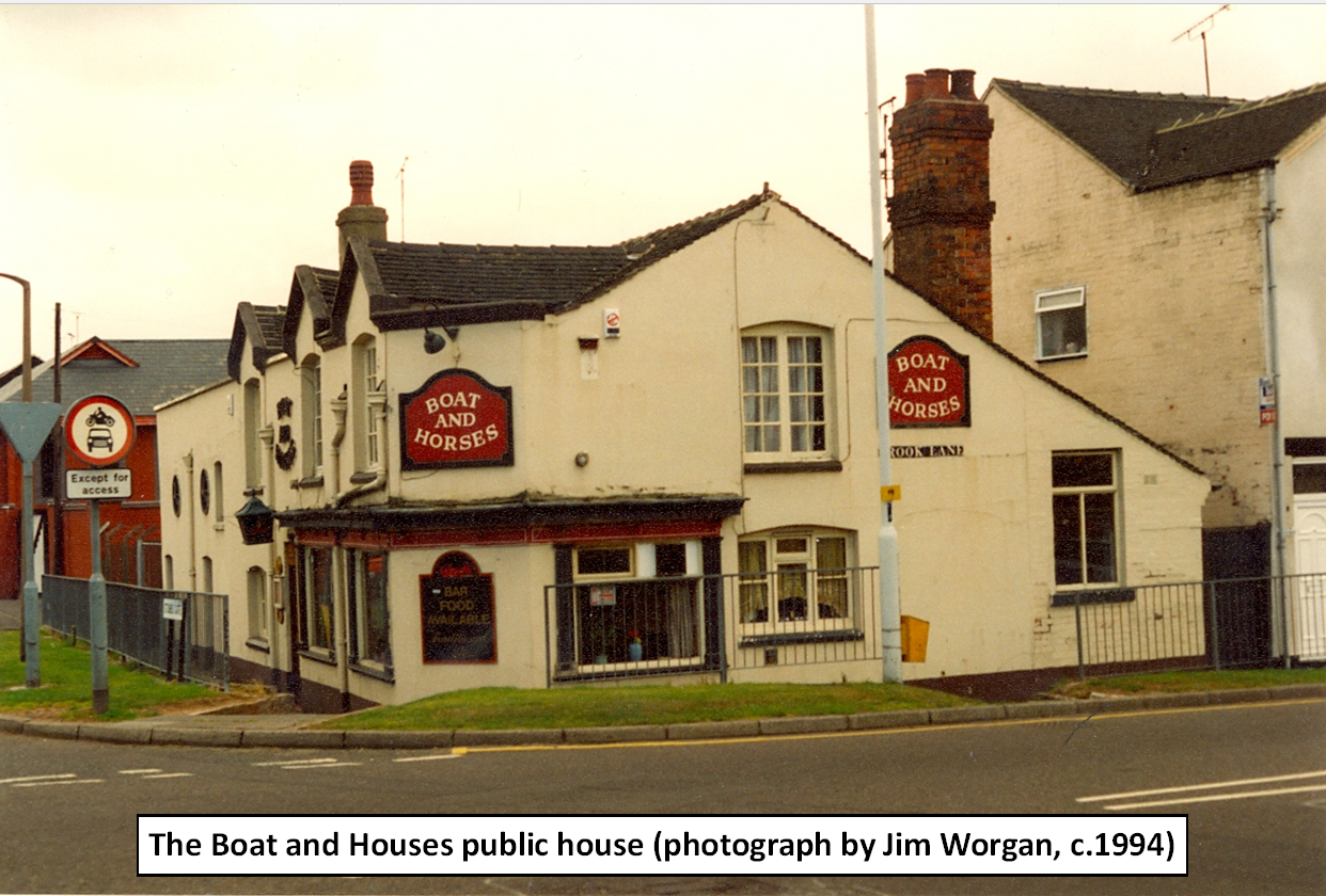
2) The Boat and Horses public house (by the entrance to Stubbs Gate, opposite Morrison’s supermarket) takes its name from the Newcastle Canal.
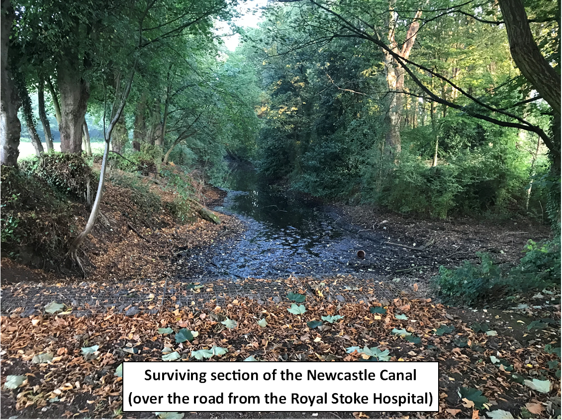
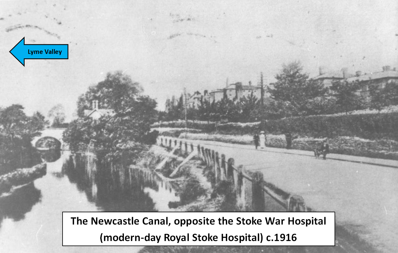
3) Very clear remains of the Newcastle Canal can still be seen opposite the entrance to the Royal Stoke Hospital (i.e. by the entrance to Lyme Valley Park).
4) The Newcastle Canal should not be confused with the Lyme Brook. The Newcastle Canal was a man-made waterway, completely separate to the narrow, meandering course of the Brook (although both charted a similar course at points, coming quite close to each other).
5) The Lower Canal began to fall out of use by the early 20th century. For instance, we know that Wheatly & Company of Springfield Tileries were sending only one or two boats along the canal per year.
6) The Newcastle Canal was part closed and damned at Trent Vale in 1921, abandoned from 1935 and subsequently filled in.
The proposed link between the Junction Canal and the Newcastle Canal (never constructed):
Assorted images:
Maps and text by Ben Boult
Original research by Allan C Baker and Mike G Fell, authors of “Newcastle-under-Lyme Its Railway and Canal History”
ISBN 978-1-906919-13-9, Irwell Press, 2009
Share and Enjoy: These icons link to social bookmarking sites where readers can share and discover new web pages.
Also worth mentioning that Gresley's canal formed part of the line of the proposed Commerical Canal from Nantwich to Ashby-de-la-Zouch, first promoted in 1796.
From Newcastle it would have taken a higher and more direct line towards Shelton then to Longton, Meir, Uttoxeter and Burton. As a wide canal it would have been game-changing both locally and for the national network, which never got a wide route from London to the north west before the arrival of the railways.
Another interesting article Ben. It shows that history is all around in place names - Boat and Horses, Water Street - and I imagine many local people are not aware of this local link to the canalmania of the 18th century.